Early morning, the sun hasn’t yet found its way to our campsite. Get your cup of coffee, a quick breakfast. Backpacks are ready – rain gear, food, water, snacks… Load up – our destination is an hour away. Watch the morning try to claim the day, and fail somewhat – there’s a thick haze, the smoke of distant wildfires burning uncontained. It’s another bad fire year for Montana. Past cattle and hay fields, over an old wooden bridge, and into the Absaroka Wilderness to the East Rosebud Trailhead.The TLs pile out, don the packs, and off we go. This will be a long day – our destination is Rainbow Lake. Before its all over, we’ll have gained some 2,000 feet in elevation over a 7 mile trail that will follow creeks an cliffs, waterfalls, and plenty of mountain scenery. Bears? Maybe. We’re prepared, but hope not to encounter any.
Off we go. It’s a fun trail. There are no long obnoxious hauls up. Instead, it’s a little gain here, a little there. This will be mostly valley hiking, as we follow East Rosebud Creek, towards its source. As we climb ever upward, from valley to valley, we are rewarded with a lake to stop and enjoy. As we start off we can’t help but marvel at the peaks above, which have taken on the visage of something other dimensional, the smoke casting an utterly new picture of the mountain tops.

Off we go, keeping the creek to our right, south to our first stop – Elk Lake. We take a quick break, then on we go, listening to the water ever rushing to meet us – eagerly following its destined course, flowing in wild abandon, shouting its claim over the gorges we pass.

We’re several hours in, and now the trail sidles along a cliffside. Not overly high or sheer, but beware complacency. Over confidence can lead to fatal mistakes. The TLs take it in stride. We have had to veer away from the water here, away from the narrow gorge cut by the creek.

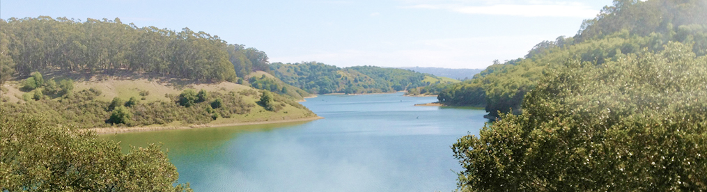
Up and over and down into the second major valley, to Rimrock Lake. And what show the lake had in store!
We meet Rimrock at its outflow. This is a narrow deep lake with water crystal clear. There is a bridge over the outflow, and even the Road Toad watch in awe as the water rushed below.

Neither Smoochy or I would want to venture into the water here. There would be no stopping. Out and down, tumbling over boulder and fallen trees, the roar of the water deafening.

No, here we were happy to have a real bridge to walk, a safe haven to enjoy the beauty of the lake, the power of the creek, and majesty of the surrounding peaks.
Ah, but there is yet another mile ahead. Continue along as the trail takes you above the the west side of Rimrock, and once again, follow East Rosebud Creek, now on our left. As before we walk through forest and open trail, ever in a narrow valley, ever conscious of the mountains surrounding us. Off to the west, a water fall. At last – Rainbow Lake. Much larger than Rimrock or Elk, this Lake begs further exploration. We lunch on boulders overlooking the water, marveling at the clarity, and as always, awed by the gifts nature has offered.

Me and Brother Smoochy chillin’ by the Rainbow Lake
Yes, seven miles in, now we must return! Another 7 back. The smoke has mostly cleared, swept away by the light breezes in the valleys. The Indians say that mountains breathe, and we believe it. Back to Rimrock, where we again marvel at the water’s power as it races under the bridge. Back along the cliff side, working our way down. It’s hot now, and we the TLs are already thinking about hot showers and happy hours. The valleys are once again of this world, the eeriness has vanished.

Back at Elk Lake, it’s only another 3 miles. We enjoy the waning afternoon, wishing our visit wasn’t drawing to a close, knowing that close it must.

And so the day ends. We’ll be leaving tomorrow for South Dakota. Brother Smoochy and his TLs have a longer drive, and will leave much earlier in the morning. We’ve had ourselves a grand good week, and will visit again another day.
Up next: Caves and buffaloes!


